The Queensland Earth Observation (EO) Hub, a partnership between the Queensland Government and SmartSat Cooperative Research Centre (CRC), has been launched with the announcement of two new earth observation research projects.
The SmartSat CRC is spearheading the development of Australia’s space industry by bringing industry, universities, and research together to support a thriving space industry. The establishment of the EO Hub aims to accelerate the growth of Queensland’s, and Australia’s, Earth observation industry by supporting commercialisation of research, and EO product and service development. The Queensland Government and SmartSat CRC are investing AU$1.5million each to deliver the EO Hub in Queensland.
Queensland Deputy Premier and Minister for State Development Steven Miles said cooperation with SmartSat CRC was bringing new industries and jobs to Queensland.
“We have lift off with the Earth Observation Hub launching in Queensland, creating more jobs and ensuring Queenslanders are at the forefront of the space industry,” Mr Miles said.
“The two new projects are both about keeping Queenslanders safe, with one of them combining satellites, local networks and edge computing to demonstrate how we could monitor remote geohazards such as flood water levels or landslides in real time, the other will use satellite and drone imagery and analytics to monitor Queensland’s extensive coasts for hazards and conditions.
“With a space industry based here in Queensland we can safely say, this is one small step for Queensland and one giant leap for Queensland jobs.”
The two successful Queensland based projects represent a near AU$900,000 investment from the Queensland EO Hub and industry. The grant program is fostering the creation and commercialisation of space-related research and innovation in Queensland. The aim is to empower the space-related industry ecosystem of Queensland, creating State-based opportunities for industry-led R&D with SmartSat CRC’s current partner base and beyond.
SmartSat CRC CEO Professor Andy Koronios says satellite systems are an integral part of Australia’s space industry, with applications for use across a wide variety of sectors.
“We’re very excited to launch our Queensland Node, the Earth Observation Hub, with two ground-breaking space technology projects. We are hugely appreciative of the opportunity we have, thanks to the Queensland Government and our industry partners, to progress them. Only by bringing together the best of Australian research with industry can we realise the growth opportunity of the space sector.
Projects such as these plant the seeds of space technology innovation and will be instrumental in helping Australia build a viable space sector,” Professor Koronios says.
“With the Queensland EO Hub we’ll be able to bring world-leading research in space conducted by our partners into the National Space Industry Hub.”
PROJECT 1: Localised GNSS IoT networks and satellite broadband communications for remote geohazard and structure monitoring
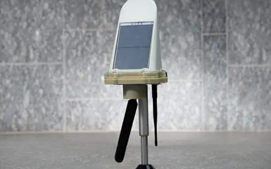
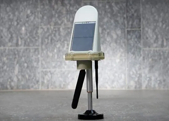
Global navigation satellite system observations are critical for monitoring geohazards and safety of natural and artificial structures and assets, such as tailing dams, landslides, bridges, and flood water levels.
This project will demonstrate the technological feasibility of combining local area Internet of Things networks, edge computing and satellite broadband communications for earth observation. Conducted by Queensland University of Technology in collaboration and Queensland-based Monitum Pty Ltd, the project’s expected outcomes include the design of a new satellite-IoT system, and prototypes of an GNSS IoT platform end-devices, and a baseline processing engine.
PROJECT 2: COASTS: Coastal Change Observation and Analytics (multi-) Scale (multi-) Technology System
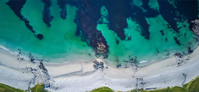
Understanding complex coastal processes and interactions between land, sea and human communities is a primary concern for both government and industry. Frequent, high-quality spatial information across Queensland’s coastal zone is required to monitor, manage, and predict coastal change and its associated hazards, but is seldom available. The Coastal Change Observation and Analytics (multi-) Scale (multi-) Technology System, COASTS, will directly address the issues of lack of coastal monitoring data using of satellite imagery, drones, numerical modelling, artificial intelligence-based analytics, and cloud-based technology.
This collaboration between the University of the Sunshine Coast, Queensland University and EOMAP Pty Ltd will cost-effectively derive and deliver information and tools that fill the gaps in our understanding of coastal processes, coastal hazards, and beach safety.
In addition to these two projects, the EO Hub will generate opportunities for data analytics businesses and researchers, as well as downstream industries and upstream service providers of Earth observation imagery. It is supported by Queensland’s Department of State Development, Earth Observation Australia Inc., The University of Queensland, the Australian Space Agency, and Geoscience Australia.
