The Australasian Space Innovation Institute (ASII) has announced a $15 million National Digital Twin for Australian Agriculture, marking the institute’s first major flagship project.
Launched in Adelaide, the initiative aims to develop a sovereign, AI-enabled geospatial digital twin designed to support coordinated decision-making across Australia’s agriculture, forestry and fisheries sectors.
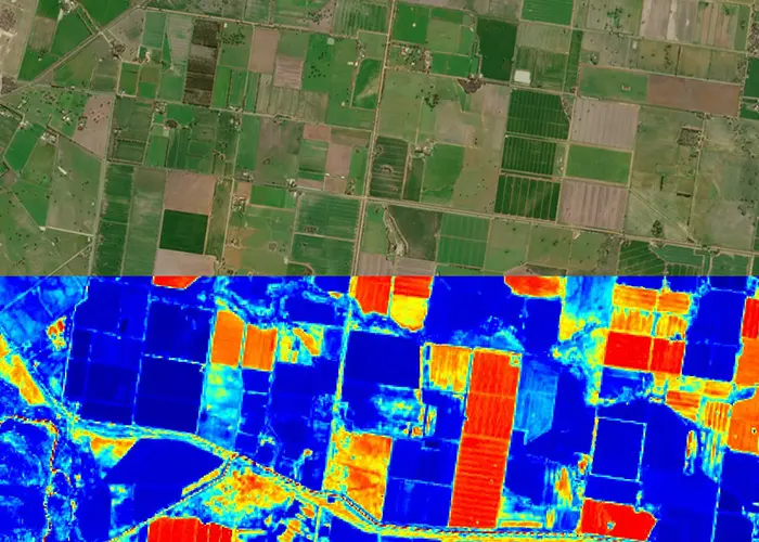
The proposed digital twin will integrate satellite Earth observation data, IoT and ground-based sensors, climate datasets and agronomic models into a shared digital environment. The goal is to create a dynamic virtual representation of agricultural landscapes at a national scale, enabling scenario modelling and data-driven planning.
ASII said the platform is intended to function as a national research and development capability, allowing stakeholders to test productivity, biosecurity, water management and climate resilience scenarios before implementing changes in the field.
The project is supported by Elders, Meat & Livestock Australia and Charles Sturt University. The university’s Australian Agricultural Data Exchange is expected to contribute to integrating and structuring agricultural datasets within the digital twin framework.
ASII founding CEO and Managing Director Professor Andy Koronios said the initiative is designed to address the lack of a shared national capability for translating agricultural data into decision-ready insights at scale.
Industry partners said the platform could enable faster testing of research hypotheses and management options in a virtual environment, potentially reducing the time and cost associated with large-scale field trials.
The institute said the digital twin will operate as independent national infrastructure, with a focus on supporting productivity, resilience and long-term sector sustainability through improved data integration and modelling capabilities.


