Satellite imaging software developed by Starboard Maritime Intelligence to monitor fishing activity can also severely disrupt illicit ship-to-ship transfers and other illegal on-water activities.
The New Zealand-based company told Space & Defense at the Avalon 2025 Air Show that its platform is unique because it draws data from multiple sources to provide clients with total maritime domain awareness.
New Zealand’s Customs Service, Department of Transport, and Department of Primary Industries, among others, use the software.
“Starboard analyses multiple sources of satellite data,” a spokesperson said. “This information is combined in near real-time and delivered by our secure web-based platform. We highlight dark vessels, displaying the image, exact location, timestamp, and type of satellite data used. The satellites pick up radio frequency emissions from marine navigation radars. Detected vessels are sometimes missing their self-reported location data. There can be valid reasons for this, but often it is a sign of bad intent.”
Starboard’s software automatically analyses global shipping movement data. The company’s proprietary algorithms and machine learning models process over 4,000 vessel positions a second. It then layers on wide area radio frequency data and high-resolution radar and optical imaging. The data allows Starboard’s customers to direct assets to “high-priority areas.”
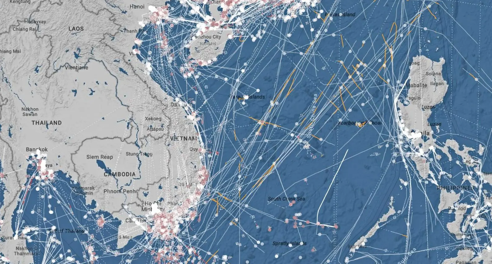
Starboard originally developed its software to track trawler movements and help the New Zealand Government better manage its fisheries. However, as shown during a demonstration to Space & Defense, it can monitor on-water ship-to-ship meets. In a shown example, it was a Malaysian-registered tanker transferring fuel to an Iranian-registered tanker in the South China Sea in breach of US sanctions. The software can also monitor drifting vessels in areas where there are underwater cables and other offshore assets.
Vessels cannot evade satellites
Satellite imaging is particularly useful to track vessels when they turn off their automatic identification system, or AIS, which transmits a ship’s position so that other ships are aware of its position. There are legitimate reasons, including safety, security, and maintenance, but it is often a sign of illegal activity.
“The type of satellite data we use, and which company we partner with, depends on the target vessel type and location,” the spokesperson said. “We’re data agnostic and focus on using the most appropriate information for the challenge at hand.”
Starboard focused on fisheries because the industry is vital to many smaller South Pacific nations. They often have limited enforcement resources but big economic zones. Surveilling fishing vessels is not just about keeping unauthorised trawlers out of a particular country’s economic zone, it is also about ensuring authorised vessels don’t overfish.
Starboard Maritime Intelligence says its is relatively easy for any government or entity to use open-source AIS data to track vessels, assuming the ship has it turned on. But they say they are the only platform offering high-level analysis of a vessel’s behaviour. The spokesperson says multiple government agencies worldwide use Starboard’s software, including Japan’s fisheries department, and some private companies, such as security services. The spokesperson says there is interest from Australian agencies and that the company is pleased with the “quality” inquiries it has received at the Air Show.


